وبلاگ تخصصی زیرساخت اطلاعات مکانی (SDI)
علمی، آموزشی و خبری (ایران و جهان)وبلاگ تخصصی زیرساخت اطلاعات مکانی (SDI)
علمی، آموزشی و خبری (ایران و جهان)
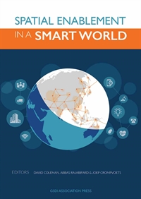
کتاب مقالات کنفرانس SDI 2016 منتشر شد
This book is the result of a collaborative initiative between the Global Spatial Data Infrastructure Association (GSDI), the University of New Brunswick, the Centre for SDIs and Land Administration (CSDILA) in the Department of Infrastructure Engineering at the University of Melbourne and University of Luven. The articles featured in this peer-reviewed book were mostly the result of the traditional Call for Papers for the GSDI Geospatial World Conference Spatial Enablement in Smart Homeland, including three main topics of Smart Disaster Prevention, Smart Transportation and Smart City, but also contains contributions of full articles which were solicited for publication in this book.
نقشه وضعیت NSDIهای کشورهای دنیا
How many countries in the world have developed or are in the process of developing SDI and SDI like proposals that are/were prepared and being implemented in ‘various countries/organizations?
By: Munir Ahmad & Asmat Ali from Pakistan
More information: https://www.google.com/maps/d/viewer?mid=1596RIb8g_n0LPyi55-N1E2PuDw4

A New SDI Model & its Components
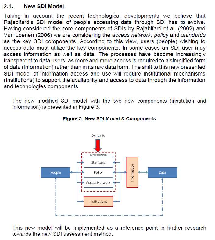
The STIG – A new SDI assessment method
Ref:International Journal of Spatial Data Infrastructures Research, 2015, Vol.10, 55-83
معرفی یک مقاله کاربردی در رابطه با SDI
A Spatial Data Infrastructure Integrating Multisource Heterogeneous Geospatial Data and Time Series:
(2016)
Abstract: Currently, the best practice to support land planning calls for the development of Spatial Data Infrastructures (SDI) capable of integrating both geospatial datasets and time series information from multiple sources, e.g., multi temporal satellite data and Volunteered Geographic Information(VGI). This paper describes an original OGC standard interoperable SDI architecture and a geospatial data and metadata workflow for creating and managing multisource heterogeneous geospatial datasets and time series, and discusses it in the framework of the Space4Agri project study case developed to support the agricultural sector in Lombardy region, Northern Italy. The main novel contributions go beyond the application domain for which the SDI has been developed and are the following: the ingestion within an a-centric SDI, potentially distributed in several nodes on the Internet to support scalability, of products derived by processing remote sensing images, authoritative data, georeferenced in-situ measurements and voluntary information (VGI) created by farmers and agronomists using an original Smart App; the workflow automation for publishing sets and time series of heterogeneous multisource geospatial data and relative web services; and, finally, the project geoportal, that can ease the analysis of the geospatial datasets and time series by providing complex intelligent spatio-temporal query and answering facilities.
Keywords: Spatial Data Infrastructure (SDI); Geospatial Data (GD); time series; Volunteered Geographic Information (VGI); metadata; Smart App; geoportal; agriculture
نمونه ای از NSDI Leaders Forums و شرکت کنندگان آن
As part of the development of the NSDI Strategic Plan, the FGDC held a series of NSDI Leaders Forums to engage leaders of key geospatial organizations in the early stages of the planning process, gather initial input, and seek continuing involvement. Sessions were held in March, June, and August 2013, and in August 2014. These meetings have been very helpful in providing a forum to discuss issues concerning the development of the NSDI and as a means to develop common understanding and approaches. Participating organizations included:
 NSDI Leaders Forum, March 2013. | |
پانزدهمین کنفرانس GSDI 2016
GSDI 15 Conference 2016 Call for Abstracts/Papers/Workshops
From 29 November to 2 December 2016 at the Taipei Nangang Exhibition Center
The GSDI 15 Conference Organizing Committee
Contact: gsdi-15-info@gsdi.org